Overview
We have been to the Philippines biking seven times. Once in November 1997, and the rest of our visits 1998, 2007, 2008, 2012, 2015, 2016 (January to April) and 2017 (January, 10 days).
In 2015, we added a new island, Palawan. We returned in 2016 to discover every road to the north.
We found in 2015 a new Trans link Eco Highway in Negros from Bacolod to San Carlos. Arduous and rewarding. We did this again in 2016 because it is such a great ride!
Now, in Luzon especially traffic conditions are growing worse faster than roads are being improved.
Only one thing has really changed: the amount of traffic. Some places it makes little difference but now around the cities of the Visayas the traffic can be heavy.
There are over 7000 islands in the Philippines. Imagine how many kilometers of coast line there are. If you’re after endless stretches of tropical beaches with roads running along side them then this is the destination for you. For us, the complex of smaller islands in the middle, the Visayas, was the highlight. These islands connect with car and pump boat ferries so that the trip is continuous. The traffic level, other than around the major cities, is light since it’s far easier to transport goods and people by water.
Biking out of Manila is not recommended. We tried it and gave up in 1996. In 2016 it takes hours to go 5 miles by car. The two large islands, Luzon and Mindanao offer two very different cycling experiences.
We tried Mindanao and aborted. The traffic levels were too high and the roads were too narrow. This is a lethal combination. Luzon, on the other hand, north or east of Manila is excellent biking with especially spectacular scenery.
Lastly, the Filipinos are very sociable and tolerant and their natural openness surprises many visitors. The Filipinos are laid back, happy and kind. They are also so inexact that it is frustrating. Recognize that their culture has been overwhelmed by our western culture. But let me hasten to say that their acceptance of Pop Western music, Karaoke and ball room dancing can be lots of fun.
How We Rate This Trip
Roads: 7

Typical Church from 1800’s
The quality of the roads varies, it seems, by the kilometer. The big issue is that some of the main roads can be in very bad repair. Repairs, here, take a long time and the funds for this can “disappear”. However, armed with good information (long distance bus drivers) you can frequently find good roads even if they are secondary roads. In the northern Luzon mountains, the roads continue to be rough dirt and they are being improved slowly. They told us the project is to be completed by 2012. As complex as the terrain (mountainous islands) is the road system is largely very good. Avoid the spider web of ill maintained and clogged roads around Manila. Generally speaking, stick to the good main roads around Luzon. Some of the grades in the interior are very tough. In the Visayas, the roads run along the coasts and usually reach around every island. Occasionally they are unpaved but fairly well maintained, by 2012, the coastal roads and main roads in the Visayas have been improved. UPDATE 2/15. Many of the roads are now improved in the islands.
Traffic: 7
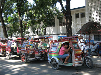
Most popular form of transportation
In 2012, the coastal highway on the northeast coast of Luzon has become clogged with traffic. When the road is the only main road north, it becomes treacherous. From Subic City to 100 Islands, and then from above San Fernando the traffic level is lower and manageable. Southern Luzon is better, often with good roads. Around the Visayas, the roads are generally quiet except around the big cities especially Cebu City and Bacolod. Have I mentioned the horrible conditions in Manila? Stay away.
Weather: 8
In 2008, it was the year of La Nina. The weather was very wet. For 90 days, the best weather we had was in the mountains of Northern Luzon. This was very atypical. We experienced days in January of all day rain. It’s a tropical climate. The dry season is generally from November to May but because of complex topography, there are variations in this pattern. It’s less predictable than on the main land of Asia. The hottest month in the Visayas is April. In 2012, the daily and even hourly variation in the dry season is a given. Totally unpredictable but it is always warm. UPDATE 2/15. March was almost rain free.

Claimed as the most perfect cone volcano, Lagaspi City, S. Luzon
Winds: 6
From November to May the winds are from the Northeast and mostly moderate and predictable. On the east coasts (on the lee side of the mountains), the winds got knocked down and became variable. In the Visayas, the winds are frequently a non-factor, but into the wind can sometimes be tough. In the northern most part of Luzon, the winds (and rain) made it impossible to ride for a few days. The locals said that it was not typical but it did happen. If it is windy in the Philippines, you will get the brunt of it since you are either in the mountains or along the coast. UPDATE 2/25. NE but vary in intensity.
Scenery:
Because the rains continued into the so called “dry season”, the country side remained green and lush. There are endless picturesque beaches that the roads run along. In the mountains, especially in Luzon, the mountain scenery is sensational. The rice fields of northern Luzon are spectacular (if you have good timing). Like in most of Asia, a beautiful view is not a value. In Culasi, on Panay Island, we were on a beach, with hundreds of full pig pens, watching an incredibly colorful sunset over a bay studded with small islands. Welcome to the Philippines.
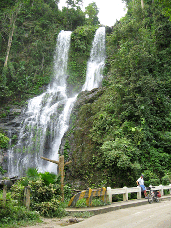
Waterfall on route to Puerto Galara from Calapan -O Mindoro
Information: 3
Good information is hard to come by. Tourist information offices know close to nothing about roads that are out of their towns and never have local maps. There is, Cycling Philippines by Jens Funk and Martin Langewoord. This bike book is worth having, for the Visayas but isn’t completely reliable. There is a website by Jens Peters (lives in the Philippines and formally wrote for Lonely Planet) www.travelphil.com. His latest guide book is from 2005, Travel the Philippines. The Lonely Planet only updates Jens Peters original writing. Local Filippino’s information is very limited, they know their city but not much farther. We met two foreign cyclist and on week-ends we would see local cyclistss in groups. Local cyclists know only their area of an Island.
Road Safety: 7
The Filipinos are very forgiving and respectful drivers. It becomes a simple matter of avoiding the busy main highways. Around Manila, Cebu City, Bacolod the traffic is heavy. The quiet roads in the rest of the country, especially the Visayas, offer very safe conditions. The drivers are no more or less courteous than in any other Asian countries. But they are basically kind.
General Safety: 8
It was simply a pleasure to not live defensively. Crime is still only an urban happening. Even in the smaller cities, its very safe. In the countryside, crime is almost never an issue.
Value: 5
In 2012, prices have gone up. Its no longer cheap by Southeast Asian standards. Mostly, hotels are priced 50% higher for the same quality of room in as the rest of South East Asia. Other than that, everything else represents good value. UPDATE 2/15. Hotels are now overprices and food costs are up.
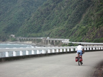
Northern Luzon, Bridge along the coast
Fluids: 8
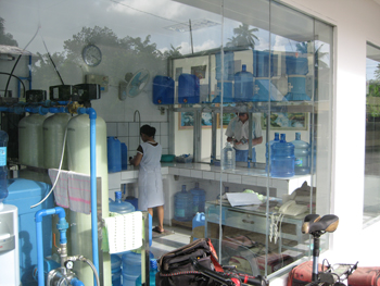
They now have clean water stations in almost every town where you can get your water bottles cleaned and filled with filtered water for almost nothing. San Miguel beer is light and agreeable for the tropics. Gatorade, soda pop etc is usually available. They value cold but often don’t fire up the fridge. We used ice everywhere.
Food: 6
In 2012, we feel that Filipino food is underrated. Granted it’s not as distinctive as the other Asian foods, but they have great grilled chicken and pork. Specialty restaurants serving these are really good. We also liked the Filipino breakfast. I’ve never knowingly eaten dog. A nice thing about restaurants in the Philippines is that it’s expected that you look into their offerings that are put out in pots. In one place, I inquired about what I was looking at. “It’s the meat of the dog, sir.” Their menu consisted of dog meat, dog curry and a whole dog head. We left.
Accommodations: 6
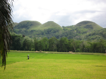
Chocolate Hills, Bohol Island
In 2012, seldom were we forced into substandard rooms even in smaller towns. The cost of a room is now much higher. A big issue was the claustrophobic window-less tombs which gave us the willies. We’d make sure there was a window. UPDATE 2/15. More accommodations but relatively pricey.
People: 10
The greatest resource of the Philippines is the people. They have a manner that is so becoming. If you’ve ever encountered a Filipino anywhere, you’ll remember their kind, gentle, easy going and fun loving manner. So often around the world, you encounter Filipinos in service businesses. Their naturally soft manner makes them supremely qualified in these “people to people” jobs. It is such a pleasure to be surrounded by these people.
Culture: 6
Purified water stations in every town
I could tell you about the swirl of these cultural crosscurrents but in reality, this is the pop culture capital of Asia. There is karaoke, ballroom dancing and garishly decorated cars, buses and homes. All of them are delightful. It is the land of “Sappy songs and slogans.” They are apologeticaly influenced by the current pop culture. They are renowned around Asia for their western pop music and their music groups who get top billing in all of Asia. It seems that there national sport is cock fighting. In the back country, if you can get there, there are still people who live as tribal units but they are hard to find.
History: 4
The surviving cathedrals are special. In fact, there is the same feel here as in Central American: Drab Cities with beautiful churches and they even have the central squares in the center of the towns (left over from 400 years under the Spanish). Other than Intramuras in Manila, you seldom encounter historical buildings. It’s the land of typhoons, earthquakes and volcanoes and they have taken a toll. Perhaps the most interesting historical aspect is the sites of the World War II battles.
TOTAL SCORE 100
Route Descriptions and Maps
Palawan
Negros Island
Visayas Islands
Romblom Islands
Palawan
March 2016
El Nido to TayTay 62K
Newly completed cement road. Moderate rolling. Serpentine. Strong fickle winds. Quiet. Great views. At 18Ks. up 1K, down 1K. At 20Ks, road construction. 90% complete to 35Ks. Flatter. Climb to 42Ks, down and up then down to 45Ks. 1K gravel, flat. Headwind. At 52Ks, more construction to 54Ks, mostly flat. Junction at 60Ks. 2Ks into TayTay at 62Ks.
Side trip from El Nido out to end of paved road, 14Ks
Start out over a steep 1/2K hill then easy. Past airport. So-so scenery, all inland. At9Ks, Marker 283, left. End of pavement at 14Ks, then ride able dirt road to ?. Tail winds back.
TayTay to Roxas 74Ks
2Ks to Junction. Narrow 2-lanes. Quiet. Rolling then gradually up. Steeper near the top at 10Ks. Steep then gradual. Now, steep hills. At 15Ks, easy rolling then flat. Strong tail winds. Then rolling again to 36Ks. Climb up to 38Ks, down and up to 40Ks. Now rolling down to 52Ks. Junction to San Vicente (13Ks, road being cemented). Now rolling to 65Ks. 1K climb. All inland. Scenery only ok. At 69Ks, steeper ups and downs into Roxas at 74Ks.
Junction to San Vincente 15Ks
Up and down. Rough terrain but well engineered road. Mostly moderate and mostly up to 6Ks then mostly down to 11Ks, flat then a moderate hill before San Vincente at 15Ks.
Roxas to Honda Bay 67Ks
Along sea then gradual climb then rolling inland. At 10Ks, turn for Port Barton (22Ks in, hilly and now under construction). At 14Ks flat. At 17Ks rolling. OK scenery. Light traffic. Light tailwinds. At 28Ks, hills, distant sea views. At 44Ks along the coast. Hills. Honda Beach from 65 – 80Ks. We were at 67ks.
Junction to Port Barton 22Ks
(Ride able but not quite finished) Good scenery. Rice valley. Good easy grades. Good new concrete road to 14Ks. Construction starts with gradual rolling up to top at 18Ks Dirt road, some concrete, steep 2Ks down into Port Barton.
Honda Bay to Puerto Princesa 67Ks (side trip to Sabang – Under ground River and Nagtabon Beach)
Along the sea (no views) then inland. Flat or easy rolling. Tailwind. At 28Ks, road for Sabang.
At K37 Junction to Sabang 36Ks one-way (Under ground River)
Cement road, moderate rolling hills to 11Ks then steep hills. Light traffic. Curves. Good scenery. 2Ks down to seaside at 15Ks then climb 2Ks. Then choppy hills, often steep. At 24Ks it mellows out (Whew!) to 30 Ks. Choppy steep hills again for 2K. The gradual descent to Sabang at 36Ks. Tough and frequent steep hills. (We took a pump boat from Sabang to Port Barton, 2 hour trip)
From Junction at K37
2K moderate climb. Good vista. down . Moderate hills to 41Ks then easy rolling. Easy climb to 47Ks then down easy rolling to 52Ks, rolling to 60Ks, road widening not finished.
Junction in Bacungan at 23Ks from Puerto Princesa to Nagtabon Beach
8.6K rolling on a paved road for 7Ks. Up a steep short hill, stay left. Steep scrabble road for 1.6Ks to beach. (return 17Ks)
From Nagtabon Beach Junction, urban traffic starts to pick up to 67Ks and Puerto Princesa
Negros Island 2016
Bacolod to San Carlos 86Ks via the Trans Link Eco Highway (New Highway)
(hard to find a person who knows about this route)
City streets south 3Ks from the ferry terminal. Left on “road to Murcia”. 4-lanes. Murcia at 15ks. Now 2-lanes with shoulder, light traffic. Mostly a cross wind. Good scenery. At 20Ks, turn into strong head wind. Moderate, steady climb to 32Ks. At 37Ks, rolling down then steep down to 41Ks cross river, then steep up. Now steep ups mostly to San Benedicto, at 45Ks. Beautiful. Now more down than up. At 52Ks, moderate down hill. At 58Ks, steep down to 60Ks. Up Moderate to 66Ks. Rolling to 70Ks, Vista Point, down. Spectacular. Some steep. Some a bit rough. Into San Carlos at 86Ks. (Arduous but rewarding). Update 1/17: From 37Ks to 70Ks, up and down.
San Carlos to Basak Port 38 Ks
Variable road surface. Occasionally rough patched tar road. Mostly flat. Tail winds. Good views of mountains and sea. Light traffic but some sugar cane trucks. After 18Ks road is generally better. Basak Port at 38Ks and Bulado Port at 42Ks. Ferries to Cebu, Tangil Port daily from both. No one knows the schedule till you are there. Update 1/17: Road improved for 70% of the way.
We rode to Guihuligan at 51Ks but the port is no longer active and there are no accommodations in the town. Update 1/17: This port is active again.
Philippines 2008 with updates from 2015 around the Visayas
Panay Island
Iloilo to San Jose 97Ks
4-lanes out of town then good 2-lane road with a marked shoulder. Flat, urban and busy to Oton at 11Ks. The road narrows but the traffic diminishes. Tigauan at 22Ks. Now, good sea views. Quieter at Miagao at 40Ks. Some minor hills. At 53Ks, San Joaquin. At 60Ks, Tiolas, start inland. Moderately climb to 68Ks. Some broken parts of road. Good views. Rolling hills to 71Ks then mostly down to 80Ks. At coast at 83Ks, Flat , rice fields. More traffic into town, 97Ks. Update 3/15. More traffic out of San Jose, narrow road. NE winds.

Guimaras – Island off Iloilo – March 2015 – Day Trip – 48Ks round trip
Ten minute ferry from Iloilo to Jordan. Jordan to Alobijod (Alubihod) 24Ks. 8Ks up to San Miguel (a big town). Road construction. Some traffic. Road finished to 12Ks then older road. At 14Ks, good road, light traffic and great vistas. At 15Ks, gradually down. At 22Ks, right gradual down to Alobijod. Older road. Return total 48Ks.
San Jose to Culasi 92Ks
Urban out on narrow 2-lanes. Ricefields. At 15Ks, Belison. All flat. Nice rural scenery. Traffic diminishes. At Patnongon 25Ks. Slightly rolling to Bugasong at 42Ks. Barbaza at 61Ks. Good scenery. Soft head winds. Light traffic Good Ocean views. Flat, right along the sea. Culasi 92Ks. Update 3/15. To San Jose. More traffic but mostly small (Motos). Busy road into San Jose. NE winds.
Culasi to Pandan 35Ks
Quiet 2-lanes, narrow good concrete road to Sebaste at 20Ks. Strong NE (head) winds. Nice rural scenery. At 35Ks, Pandan.
Pandan to Phaidon Resort 7Ks.
UPDATE 2/15. This is now a beautiful concrete road. ( Old Post for History: Welcome to the Philippines. The money disappeared and this road is in disrepair. But your able to ride, just slow. Dirt road with a lot of pot holes. Mostly flat. 7Ks. (The road around this peninsula is now very rough 2012.)
Phaidon Resort to Caticlan via the old Spanish road 46Ks
NEW 2/15. New concrete road that follows the original Spanish road, almost flat along or near the coast. NE (tail) wind. Very quiet. Great scenery. At 14Ks, Liberdad. Now rolling and inland. Moderate ups and downs. At 23Ks, back to coast. Good views. A few minor hills. Now headwinds. At 30Ks, Buruanga. At 32Ks, inland and climb moderately to 35Ks the down steep for 1K then gradual to 40Ks, Malay. Along coast flat past the airport (actually cross at the end of the runway, they close the road when planes are landing and taking off) to Caticlan at 46Ks.
Pandan to Caticlan 35Ks
The road cuts across the peninsula and has some gradual hills. Quiet. 2-lane, NE winds (head) to Nabas junction at 11Ks, straight. Nabas at 12Ks, left. Some medium climbs and descents. Along the coast. We had rain and fog in 2008 but in 2012 we saw beautiful vistas along the coast. The ferry dock for Boracay in Caticlan at 35Ks. UPDATE 2/15. Before Nabas, the road is narrow but light traffic. Some winds. After Nabas, more traffic. Buses and vans from Kalibo. Road is being improved.
Caticlan to Boracay by pump boat ferry (10 minutes)
Boracay Island
Busy with small traffic. From the Pier it’s 3 – 8Ks to White Beach, depending on where you stay. Hilly.
Boracay to Caticlan by pump boat ferry
Catilcan to Roxas by ferry
(From the pier its 2 Ks into town).
In 2015 we took a ferry from Roxas (Mindoro Island) to Romblon Islands and from Romblon Islands to Caticlan (Panay) We repeated this trip from 2012.
Roxas, Mindoro to Odiongan, Tablas island by ferry – 4 hours in a pump boat.
Odiongan to San Augustin 53Ks
UPDATE 2/15. The road is 98% paved. A 1K dirt road after the top of the pass. Older parts of cement road are getting rougher. FUN RIDE. Original post follows: Mostly inland. OK scenery. Paved except for a few rough patches. A couple minor hills. North (head) winds to San Andres at 18Ks. Older concrete road to 26Ks then rough and muddy (good scenery and quiet) to 35Ks. Some concreting going on. At 37Ks Calatrava. Start moderate climb. At 39Ks, dirt road (better condition). Top at 42Ks. Great views. Under construction. A little muddy steeper down. At 47Ks, new concrete. Rolling into San Augustin at 53Ks. (Once the road is completed, it will be a great ride. It will take time to finish.)
Pump boat from San Augustin to Romblon Town (Romblon Island) 30 minutes
Romblon Town to Romblon Town 43Ks
UPDATE 2/15. The road paved to 14Ks and more surfacing is being done but basically the same to 26Ks then improved, widened road. Best on a mountain bike. Original post follows: South out of town on a paved (a little broken) road for 12Ks along the coast. A few minor hills. Quiet and beautiful. At 12Ks good dirt road but it gets rockier. Steep ups and downs all the way to Sablayan at 23Ks. Gradual (sometimes moderate) for 7Ks then rolling down. Sometimes rocky, sometimes muddy. At 31Ks paved through a valley, then on and off (under construction) pavement. Moderate climb to 38Ks (the top at 130 meters) Great vistas and all paved now.
Romblon Town to San Augustin by pump boat
San Agustin to Looc 52Ks
UPDATE 2/15. At 27Ks, paved but still some construction. The road is 99% completed. Original post follows: South along coast. Paved but a little broken in spots. Many choppy hills. Great coastal scenery. At 20Ks, steep 1K up then down short rise then down to Santa Maria at 24Ks. One choppy hill. At 27Ks, dirt road and construction to 31Ks. Continues mostly rolling. At 33Ks, the Airport. At 37Ks, rough pavement to 39Ks. At 41Ks, Alcantara. Rolling to 45Ks, turn for Santa Fe (9Ks) straight. Mostly a broken road. Minor hills. In land. At 52Ks, Looc.
Looc to Odiongan 24Ks (New 2/2015)
Short ups and downs to 5Ks then 5 climbs (1K each). Inland to 16Ks. Good rural and forest scenery. NE (head) winds, light traffic. Good road. At 16Ks, mostly down into Odiongon at 24Ks.
Looc (Tablas Island) to Caticlan (Panay Island) via pump boat.
In 2016 we took a new route from Romblon, Romblon to Pilar Harbor on Luzon Island via Car Ferries, a pump boat and biking across two islands.
Romblon town to Magdiwang, Subuyan Island by car ferry 2 hours. (Most of this island is a national park)
Magdiwang to Cajidiocan Pier 38Ks
From Magdiwang pier to Magdiwang 3Ks. Flat. Pretty. Paved to 7Ks, then dirt. A bit rockey and bumpy. Better on a Mountain Bike. Head (NE) winds. Sometimes dusty. To 33Ks, 10% paved, then all paved to Cajidiocan at 38Ks. This route is along the coast. (3 more Ks to German Village, paved).
Cajidiocan Pier, Subuyan Island to Mandaon Pier, Masbate Island via Pump Boat 4 hours
Mandaon to Masbate City 64Ks
Rolling hills, 2 lanes, no shoulder, paved. At 18Ks, bear right. Headwinds. Light traffic. More up than down to top at 25Ks. Great views. Variability. Rolling down then rolling to Milagros at 40Ks. Junction. Left. Rolling. A little bumpy. No urban traffic into town, then at 62Ks, left to Port at 64Ks.
Masbate City to Pilar Harbour on Luzon Island by ferry 4 hours.
Roxas to Pinamalayan 61Ks – Mindoro Island
1K out to the Highway then 23Ks to Bongabong. On the flat coastal plain. 2-lanes narrow concrete. So-so scenery. NE (head) winds. Quiet. Some trucks. At 26Ks older asphalt, a little broken. Mountain views. At 37Ks, Bansud. At 50Ks, Gloria and M’s Eatery. More traffic. At 59Ks, turn into Pinamalayan. Center at 61Ks. In 2012 there was construction around Pinamalayan. Otherwise the road is good. UPDATE 2/15. All good road but narrow. Mostly small (motor bikes) traffic and few big vehicles. Now a bypass around Bongaboug. Going south, tail winds.
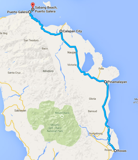
Pinamalayan to Calapan 73Ks
UPDATE 1/15. Road is 100% constructed but is 90% narrow and 10% with a paved shoulder. Light traffic becomes moderate then busy within 20 Ks of Calapan. Cross winds mostly. Original post follows: 2Ks to Highway. 2-lanes. At 10Ks, Sorocco (Pinamalayan to Sorocco is still under construction) and the turn for Pola, but this sea road does not go through. More traffic here. After 15Ks, a mild climb to 20Ks then gradual down. NE (head) winds. OK scenery. Rough black top road flattens out. Victoria at 34Ks. After Victoria, flat, straight and busy. At 64Ks, road to Ferry Pier. Right. At coast at 72Ks. Right to Pier, left to Calapan center at 73Ks.
Calapan to Puerto Galera 48Ks
4Ks in town then right. Good 2-lane road. Light traffic. Starts flat,, NE (follow) winds. At 19Ks, climb 2Ks, down 2Ks then 1K up and 1K down moderate with great views, flattens out to 30Ks. A moderate hill and then at 32Ks start climb. At 34Ks a water fall. Up to 38s, then down steep on old bad road. Dirt and rocks but you can ride for 3Ks. Continue down on a new road. Fabulous views. At 42Ks, at sea level. Gradual long hills into Puerto Galera at 48Ks. Great Ride! The entire route is good road but is subject to landslides. UPDATE 2/15. The road is complete and in good condition. Winds in February very light.
Puerto Galera to the west and return 20KS
NEW 2/15. Good 2-lane road. A few moderate ups and downs. East (tail) wind. Good scenery and sea views. Light traffic. White Beach at 7Ks. Road ends at 10Ks. (The former dirt road west has become impassable.)
Puerto Galera to Sabang 5Ks
Steep hills on narrow road. Paved but sometimes broken. Great views. UPDATE 2/15. Road is more broken.
Sabang to Calapan Ferry
It is possible to take a ferry with bikes from Sabang to Batangas but the ride from Calapan to Sabang was so great we did it again the opposite direction or as the Fllipinos would say “vice versa”.
Mindoro Island
Calapan (Mindoro Island) to Batangas (Southern Luzon Island) Ferry
Luzon Island
Batangas to Lucena 82Ks
5Ks out to Hwy to Rosario on busy urban road with a designated lane for bikes! Right toward Ibaan (Road sign). 2-lane. Moderate traffic. Short drops to rivers then gradual climb. No scenery. Ibaan at 14Ks. Narrow road. Some trucks. Sometimes Hairy. Rolling to Rosario at 23Ks. At intersection, left. Dump trucks! Yuck. At 26Ks, junction right. Less traffic. Gradual descent (fast) to 34Ks. Light NE (head) winds. Much better riding. Rolling to Tiaong. Junction at 45Ks. Right on Main Hwy. Busy. A gravel shoulder. Easy grades. At 57Ks, Candelaria. Poor riding. Gradual climb to Sariaya at 69Ks. Stronger winds. Tough because often on gravel shoulder. Rolling to junction into Lucena at 73ks then down all the way to the center at 82Ks.
Lucena to Calauag 97Ks
In 2012, there is more traffic and the road has worsened. Only a muddy shoulder. Traffic builds as the day goes on. Not recommended!
5Ks back to Highway. Rolling to Pagbilao at 10Ks. Quieter and prettier here. Sometimes the road is a little rough. At 23Ks, a steep climb for 4Ks then rolling down to 33Ks. Nice scenery. Rolling into Atimonan at 43Ks. At the sea at 45Ks. Along the shore, flat. Light NE (head) winds, Gumaca at 67Ks. More inland but flat to Lopez at 86KS. Rolling hills to Calauag at 97Ks.
Calauag to Naga 146Ks
In 2012, this road is the through traffic route so lots of big trucks and buses. Road is still broken at times especially from junction for 20Ks to 42Ks. Not recommended! Rolling up for 8Ks. Lots of curves. Light traffic. A few trucks. Then rolling down then rolling to junction at 22Ks. Right on new route to Naga. 2-lanes, gravel shoulder. First 2Ks very broken then rolling more up. At 49Ks, Tagrogy. Sometimes, a paved shoulder, sometimes steep. Light winds but rainy all day, so -so scenery. Easier hills. Now down to Del Gallego at 58Ks. Broken road but ok. More gradual rolling. At 85Ks, Ragay. More rolling and broken road. Rolling mostly down to Sipocot at 109Ks. Junction with main road. Right. 2-lanes. A little more traffic. Mostly flat. Pamplona at 129Ks. Often a narrow shoulder. Busier. San Fern at 141Ks. Now a 1 meter shoulder. Busy. Into Naga at 146Ks.
Side trip from Naga
Naga to Tinambac and vice versa 72Ks
To Magarao then Bombon then Calabanga. Into and through Calabanga proper then out along coast. Flat except for a few hills before Tinambac. The paved road ends at Tinambac.
Naga to Tigaon 44Ks
Out on 2-lane road with a wide shoulder. Urban but easy. Flat. Lots of traffic. At 11Ks, shoulder ends. Very hairy to 13Ks. Left on diversion road. 2-lanes, no shoulder. A clear day with good volcano views. Its a truck route. Again hairy. At 17Ks, junction, left. 2-lanes, good road. Some traffic. Strong NE (head) wind. Ocampo at 28Ks. Long gradual hills. Better road. At 44Ks, Tigaon.
Tigaon to Sabang 20Ks
Main road to Goa at 6Ks, San Jose at 9Ks. Junction. Right to Sabang at 20Ks.
At Sabang you can take a pump boat ferry that takes bikes and motor bikes to Caramaon. There is an option to ride to Caramaon: At junction in San Jose, straight to Lagonoy by good road then rough road to Caramaon.
Sabang to Tigaon – vice versa
Tigaon to Legaspi 85Ks
Out 4 Ks to Sagnay. 2-lane, good road, quiet. At 5Ks, climb 3Ks modertely. Great views. Drift down to 13Ks. Into bays and around peninsulas along the coast. In and out, up and down. Fabulous scenery. Soft winds. At 30Ks, back to sea level. The road is older but OK and plenty of hills. At 40Ks, sea level again. No real stores or food before Tiwi. Very Quiet. Flat into Tiwi at 45Ks. After Tiwi, always a shoulder, very quiet. No real stores or fool before Tiwi. Then easy long grades to Tabaco at 57Ks. Now there’s a paved shoulder. Rice fields after Tabaco, busier, 2-lane, flat. There is a moderate steady climb for 5Ks to 67Ks. Up the side of Mayan Volcano. At 70Ks, down off of Mayan Volcano. Moderate then gradual to 78Ks. Views of Volcano which is often obscured by clouds (we saw it!) Into the city center 85Ks. Great Ride!
Legaspi to Sorsogon 62Ks
Urban road out to junction at start of moderate climb at 5Ks for 2Ks. 2-lane, no shoulder. Moderate but fast big traffic so you have to anticipate squeeze plays. View of city. NE (tail) winds. So-so scenery. Rolling. At 22Ks, road to Donsol. (To Donsol, 27Ks of twisty curvy road. Very basic rural country side. So-so scenery. Good 2-lane road, little traffic. (This is where you snorkel with the Whale-Sharks when they decide to be there.) Moderate rolling hills. At 47Ks, a short descent to the sea then back inland. NE wind is a head wind through here. At 62Ks, into Sorsogon.
Sorsogon to Matnog 65Ks
Out of town. Flat to 17Ks then rolling. Good road. Light traffic (on Sunday). Light NE (follow) wind. At 26Ks, start gradually rolling up a pretty river valley. At 42Ks, Irosin, continue up to 44Ks then start climb, steep for 1K then rolling then another 3K, moderately steep climb to 55Ks, then down moderately steep for 2K. Then gradual down to port in Matnog at 65Ks. Good ride , some great views,

Matnog, Southern Luzon Island to Allen, Samar Island by car ferry
Samar Island
Day trip: Allen to Catarman 47Ks (94Ks round trip)
Description is Catarman to Allen. Out of Catarman on good 2-lane road. Uninteresting. Flat. 9Ks to Bobon. At all towns, a choice a) through town or b) around town. Complex coast line of mangroves, rivers and peninsulas. Calm winds. Light traffic. Some trucks. Flat along coast to San Jose at 19Ks. Some small hills. At 27Ks, Rosario. Slightly rolling, mostly inland. 1 steep 1/2K hill to Lavezares at 39Ks. 2K climb and 2K descent then rolling into Allen at 47Ks.
Allen to Calbayog 73Ks
Mostly 2-lane, good road with some parts broken concrete. No problem on a bike. Quiet. 9Ks, Victoria and long bridge. Rolling. Cross winds. San Isidro at 17Ks. Now, longer and steeper ups and downs. More rugged terrain. Rougher concrete. Slower. 2K climb to 33Ks then descend 2Ks. Still rolling. Along the mountain sides looking at the sea. At 46Ks, much improved road. Now, gentle rolling hills along coast, then inland. Flat and busier into Calbayog at 73Ks.
Calbayog to Catbalogan 70Ks
Out flat along coast then inland. Newly black topped. Then at 23Ks, gradually up river. At 31Ks, Gandara, easy grades to 40Ks then rolling hills up. At 48Ks, start down for 5Ks. Good views. At 60Ks, moderate rolling hills, into town at 70Ks.
****In 2012, we rode from Catbalogan to Tacloban, we choose not to do this in 2008 due to road construction and crossed the island to Taft.
This description is backwards and is the direct route: Tacloban to Catbalogan.****
(Tacloban to Catbalogan 107Ks)
(Out of town and over the spectacular San Juanico Bridge to junction in Samar Island at 12Ks. This route has no shoulder, left. Newly paved road, rolling then hilly and finally a 5K climb to 48Ks then gradually rolling down. Views to the sea. At 61Ks, Calbiga. Again, rolling to Hinabangan at 73Ks. Variable winds. Good scenery. Light traffic. Again rolling to 83Ks, the junction to Taft. Hilly and curvy to Catbalogan at 107Ks. More and more traffic.)
Catbalogan to Taft 88Ks
Steep climb out of town for 2Ks, 2-lane, great views. Gradually up to 4Ks. Down then flat then down to Jaibong at 10Ks. Curvy and hilly. East (cross) wind. Junction at 24Ks. turn left toward Taft on a good 2-lane road inland. Quiet, pretty. NE (head) wind. Gradual climb then down. Now, mostly flat. At 40Ks, mostly climb for 5Ks. At 46Ks, 2K steep climb then steep down to 52Ks, climb steep again. At 54Ks, Babalcan. The top at 55Ks. At 62Ks loop the loop. Great riding gradually drifting lower. Into Taft at 88Ks. Great ride from the junction to Taft. (Junction 1K before Taft. Left is a good road for 32Ks up the coast.)
Taft to Borongan 48Ks
Sulat 13Ks, San Julian 28Ks. 2-lanes, light traffic. Mostly flat. Good scenery. Mixed bag of road, 30% good, 30% so-so, 30% poor and bumpy. NE (cross) wind. A few minor hills. Into town 48Ks.
Borongan to Guiua 111Ks
Out on good 2-lane road. On shore, NE (cross) wind. So-so scenery but sometimes great sea views. Rolling. Maydolong at 21Ks. Slightly rougher road to Llorente at 38Ks. Hernani at 55Ks,. Flatter, straighter, down wind and fast to MacArthur at 70Ks. Flat and fast. At 78Ks, junction left (straight to Marabut.. See description below.) Mostly good 2-lane. Some broken or bumpy patched spots. Rolling then climb moderately to 91Ks. Views to coast on right. Gradual descent to Salcedo at 95Ks. Mostly a good road, rolling to Mercedes at 103Ks. Rolling to Guiua at 111Ks.
Guiua to Junction 33Ks
See above description in reverse.
Junction (refered to in Borongan to Guiua description above) to Marabut 54Ks
Excellent cement 2-lane road. Light traffic. Rolling inland. East (tail) wind. So-so scenery. At 26Ks, Balangiga. Longer gradual hills. Prettier. At 40Ks, along the coast beautiful. At 54Ks, Marabut. Great finish.
Marabut, Samar Island to Tacloban, Leyte Island 60Ks
Along the coast. Great views. 2-lane excellent cement road. Dramatic coastal scenery with out croppings. Funky cross winds. Little traffic. mostly flat. After 25Ks, dramatic scenery in gone. At 35Ks, Basey. Inland. Nice scenery. 1K up to 43Ks then down. At 48Ks, the beautiful San Juanico bridge. At 50Ks, junction, left. Increasingly urban and busy. 2-lanes, no shoulder. Center at 60Ks.
Leyte Island
Tacloban to Palo 12Ks
2-lanes with a shoulder. Busy. Urban. Another option: Road to Palo, at the traffic circle at 5Ks, turn toward the airport and coast. At 6Ks, junction right. At 8Ks, along coast, the MacArthur statue. Main road at 11Ks, left to Palo at 13Ks.
Side trip from Palo
Palo to Tanauan 6Ks
Palo to Burauan 31Ks
Palo to Baybay 93Ks
Palo to Maasin City 183Ks
Palo to Lioan Ferry 141Ks
Busy, dull, flat 2-lane road. No shoulder but in good repair. Road to Burauan is quieter and prettier.
Palo, Leyte Island to Naval, Biliran Island 110Ks
Narrow 2-lane road in good condition. Good straight road brings very fast, sometimes dangerous, traffic. No shoulder. Gradually up to 27Ks (Jaro) then gradually down. Nice scenery. NE (tail) wind. Carigara at 42Ks. Now near coast . At 55Ks, 3K climb and 3K descent into Lemon at 61Ks, junction, right. (Straight to Ormac – see below) Lemon to Naval. Rolling down valley. A 1K climb then 2Ks descent to Leyte at 75Ks. Steep hills up and down. Great views. Across bridge into Biliran Island at 93Ks. rolling, Nice to Naval at 110Ks.
Biliran Island
Naval to Naval 75Ks
Cut through the middle, one long climb and descent then around the North of Naval on a rough rocky road. North of Naval, the road is paved for 21Ks. Hills, curves, quiet and great scenery. (The road around Biliran Island is being paved. It will be a great bike ride. Now, 1/08 the road is too rough. The road from Biliran Town is, at first, paved and the pavement is being extended. I don’t know how far.)
Naval, Biliran Island to Lemon Junction, Leyte Island 50Ks
See Palo to Naval above.
Leyte Island
Lemon Junction to Ormoc 37Ks.
Moderate 5Ks up and 5Ks moderate down. At 14Ks, Kananga. More traffic. We rode on a Sunday so no sugar cane trucks. 2-lanes, sometimes a little rough. Dull scenery until the ocean views 5Ks before Ormoc. Gradually rolling then 5Ks down into town at 37Ks. From Kananga to Ormoc a poor ride. This is 23Ks that sensible people would get a ride.
Ormoc to Baybay 45Ks
Good 2-lane, flat, busy, truck traffic, along coast. Albuera at 14Ks. A lot of foreigners live around here Now a quiet road. NE winds come over the mountains so unpredictable. Very good scenery. Some ocean views, always mountain views. Into Baybay at 45Ks.
Baybay to Maasin 79Ks
Good 2-lane road, mostly flat. Soft variable winds. Low traffic along the sea, nice. At 25Ks, Inopacan. At 33Ks, Hindang. “Sea of Green” inland rice fields. Hilangos at 40Ks. At 48Ks, Bato, (ferry to Bohol Island). Inland, so-so scenery. At 62Ks, a gradual 2K climb then rolling. Generally down to Maasin at 79Ks.
Maasin to Padre Burgos 26Ks
Good, flat 2-lanes. Quiet. Some sea views. Tree shaded. Variable winds. Good scenery. Becomes rolling into Padre Burgos 26Ks.
Padre Burgos to Bato 63Ks
Good 2-lane road right along the coast for 10Ks to Malitbog at 18Ks. Quiet. Beautiful. Then, more along the coast. Today calm wind. Thru Tomas Oppus but before Bontoc at 39Ks is the junction (to cross over the Island). Left to 41Ks, start climb, some parts steep for 2Ks then rolling hills to 48Ks then down for 3Ks then rolling. Finally flat into Bato at 63Ks.
Bato, Leyte Island to Ubay, Bohol Island by ferry
Bohol Island
Ubay to Carmen 54Ks
Ubay Pier to Trinidad ,15Ks. Rolling, good road, quiet. NE (cross) wind, dull inland scenery. Junction, left. Rolling. Good road to San Miguel at 27Ks. Generally moderately climbing to 33Ks. Now rolling with rice fields. Good scenery. At 41Ks Dagohoy. At 47Ks, steep climb for 1K then rolling. At 51Ks, junction to Sierra Bullones. Straight to Carmen at 54Ks.
**Carmen to Ubay alternative (vice versa if from Ubay) 55Ks
Carmen to junction 3Ks (north), right (east). Good 2-lane road. Quiet. Rolling then rolling down to sierra Bullones at 13Ks. Good scenery. Paved to 25Ks. 7Ks of improved dirt road, then paved at 32Ks to junction at 35Ks. Left. Rolling light traffic. OK scenery. NE (head) winds. Ubay at 55Ks.
Carmen to Chocolate Hills 6Ks
Up steep for 1K then gradually up to 5Ks. Junction left. 1K steep to top. (See below for option: Chocolate Hills to Alona Beach, Panglao Island via the middle of the island.)
Carman to Alona 70Ks
Update 3/15. Mostly down hill, take care around curves. Often bumpy. Moderate traffic. Mostly tourists vans etc. Just completed cement highway on Panglao Island. Via a town called “Bike”. After Alona, under construction.
Carmen to Anda 65Ks
Carmen to junction 3Ks(north), right (east). Good 2-lane road. Quiet. Rolling then rolling down to Sierra Bullones at 13Ks. Rolling, good scenery. Paved to 25Ks. 7Ks of improved dirt road, then paved at 32Ks. Junction at 35Ks. Right. rolling. Nice 2-lane road. Light traffic. At 47Ks, Candijay. At 54Ks, left to Anda before Guindulman. New 2-lane cement road. Good sea views for 11Ks to Resorts at Anda 65Ks.
Anda to Jagna 34Ks
Back to highway 11Ks. Left. Rolling along coast. Excellent road. Good views. Light traffic. NE (cross)wind. Jagua at 34Ks.
Jagna to Loboc 50Ks
Excellent road right along coast. Flat. A couple small hills before Valencia at 21Ks. Dimioa at 26Ks. NE (cross) wind. Light traffic. Sea views all the way. At 34Ks, Lila. At 44Ks, Loay. Junction. (straight to Tagbilaran) Right toward Loboc. One hill then Loboc at 50Ks.
Chocolate Hills via Loboc, Bohol Island to Alona Beach, Panglao Island 68Ks
2-lanes, mostly flat, down, NE wind. This is a tourist route so some traffic. Great scenery. Rice fields with the “Chocolate Hills”. Bilar at 13Ks. Now rolling hills to 18Ks then moderate descent to 24Ks, now rolling then 1K climb to 27ks. Steep descent to Loboc at 30Ks. Flat then 1K climb and 1K down to Loay at 35Ks. Junction. Right. Excellent road, almost flat. More traffic and less scenic. Two Historic churches on the route. At 52Ks, left to bridge to Panglao Island at 53Ks (straight to Tagbilaran pier 5Ks), go left at junction up a short steep hill then gradually up for 2Ks then drift down. No views, narrow road, some traffic, Alona at 68Ks.
Alternative via Cabilao Island: see below
Alona Beach Panglao Island to Tagbilaran Pier Bohol Island 21Ks
Back to Junction, 16Ks. Left on Highway into Tagbilaran. Through town. Busy to Pier at 21Ks.
Option #2, 5ks to Panglao town then right on middle road to Bridge 21Ks. Busier and less interesting.
Option #3, 5Ks to Panglao town then right on road to Bil-isan then to other bridge into Tagbilaron at 21Ks, better route.
++(In 2012, we rode to Carman via the west coast)
Tagbilaran to Cabilao Island (*Polaris Dive Resort) 41Ks
Busy 2 land urban road to Cortes at 9Ks left to Maribojoc. Flat, north wind (rain). Less traffic. Moderate Hills. Some views. Maribojoc at 14Ks. Rolling to Loon at 28Ks. Over bridge at 32Ks, left to ferry. Paved for 3Ks then good dirt road to ferry at 37Ks. On Cabilao Island paved for 2Ks, then very rough to Polaris Dive Resort at 41Ks. *(Long muddy slog to a pricey dive resort). Update 3/15. From port take quiet pretty coastal road to Highway at 6Ks. Equidistant. Some road damage due to 10/13 earthquake. At 32Ks, pass road into Cablao Island. Minor road being repaired. Tubigon at 54Ks.
.
Cabilao Island to Carman (Chocolate Hills) 69Ks
Out to the Bohol highway at 9Ks, left. (see above). Easy riding to Calape at 19Ks. Mostly flat. Light traffic. Pretty rice fields. NE (head) wind. Tubigon* at 31Ks. Junction at 40Ks right. 5K moderate climb then 6Ks easy climb to Sogbagon at 51Ks. 2 easy Ks up then down easy for 5Ks then easy rolling. Beautiful. Carman at 69Ks. Update 3/15. At 9Ks from Tubigon, right. Road completely repaired after 10/13 earthquake. Epicenter very near.
*Tubigon – Frequent ferries to Cebu City. Good restaurants and hotels. (The better alternative to Cabilao Island.)
Dumaguette to Moalboal (Cebu Island) ferry from Sibulan Port to Lilo-An Pier 6Ks (1/2 hour)
Pass the airport on urban road to Sibulan at 6Ks. From Lilo-An Pier to Bato Pier up to highway then gradual descent to Bato Pier at 5Ks. From this pier total to Maolboad 63Ks.
Dumaguette to Maolboal (Cebu Island) ferry from Tampi (17Ks, 1/2 hour) to Bato 74Ks
To the ferry at Tampi. It’s a 17Ks flat busy road. There are two ferries one is a car ferry (one hour behind schedule in 2112) and further down the road about 1/2K is a passenger ferry. Both will take bikes. The passenger ferry is more frequent and faster. The ferry arrives at Bato on Cebu Island. (Bato to Maolboal town is 57K – road signs miss leading.) We went north on the west side of the island on a 2-lane paved road. The road weaves next to the coast and goes inland occasionally with rolling hills. This is one of our favorite rides with beautiful sea views. At Maolboal, it’s 3Ks paved road to the coast, Panagsama Beach. This is a world famous diving spot. Update 3/15. We went in the opposite direction. Now frequent ferries from Bato. Same fabulous trip but with a tailwind. Road has a narrow shoulder from Tampi. Less traffic at midday.
Maolbaol to Cebu City 86Ks
Only 3Ks back to Maolbaol town then all paved north to Aloguinsan, then to Dumanjug on good road and rolling hills. The scenery from Dumanjug to Barili is good with some hills next to the coast. Before Barill, bumpy road. (At Barili, you can take a ferry back to Guihulngan on Negros Oriental Island). We went inland to cross the island to Carcar. It was a 9Ks 5% climb on a good road and then a curvy down. Somewhat rough over the top. The boring coast road from Carcar to Cebu City got busier as we got closer to the City where the traffic was heavy. This road has a shoulder of sorts.
Cebu City,Cebu Island to Clark, Luzon Island via Cebu Air
Luzon Island
Clark Airport to Olongapo 67Ks
A new expressway is opening in 3/08. For now, 18Ks to Poroc. Bad riding. After Poroc, traffic deminishes. Down wind, very fast. Little scenery. Volcano ash so it’s dusty. At 29Ks, go past the turn for Florida Blanca. Flat. At 43Ks, right at Y junction then right again at junction at 44Ks, then a narrow 2-lane very busy road. Treacherous. Avoid if possible. The opening of the new road may alleviate much of this traffic. Flat then hills. Olongapo at 67Ks.
Olongpo to Iba 80Ks
Out Along the coast. A few hills. Mostly with a shoulder. Basically 13Ks of Subic Town. Urban riding. Beautiful road, wide with a wide shoulder. Traffic, flat. At 27Ks, San Marcellino. Junction, left to San Antonio. Straight for “Short Cut” to Iba. 2-lane, light traffic, no shoulder. Flat to T junction with highway at 36Ks. Right. 2-lane, usually with a shoulder. Cross wind. No views of sea. So-so scenery. At 80Ks, Iba.
Iba to Alaminos 117Ks
Out on 2-lanes, no shoulder, light traffic. OK scenery. Light cross winds. Inland. Long rolling hills. At 29Ks Masinloc. Flatter to Candelaria at 40Ks. Flat with a shoulder to Santa Cruz at 58Ks. Then no shoulder, again flat then inland and slightly rolling into Burgas at 93Ks. Then rolling down to Mabini at 105Ks. Then up 1K then gradually down to Alaminos at 117Ks on a busier road.
Alaminos to Lucap 6K
Pier for boats to Hundred Islands National Park.
Slightly rolling. Busy road.
Alaminos to San Fabian 68Ks
2-lanes, narrow, no shoulder and busier road. Fast busses! Rolling up to 16Ks, then down to Sual at 18Ks. Winds variable. At 28Ks, junction, left. Narrow, 2-lanes, some traffic. Busy into and out of Lingayen at 37Ks. Dull scenery. Now (thank God) a shoulder, very busy. Dagupan (big city) at 54Ks. Urban riding. Ask for San Fabian. 2-lanes, no shoulder, hairy ride. At 64Ks, junction, left. Now a shoulder. At 68Ks, San Fabian (1 – 2Ks into resorts on the beach).
San Fabian to San Fernando 58Ks
Flat along the sea, some views. Light traffic (on Sunday). At 16Ks, junction for Rosario. Now, busier traffic, inland, flat and dull. Thru Agoo to (former) Marcos Hwy to Baguio, junction at 26Ks. Straight. slightly rolling to Bauang at 49Ks. Hellishly busy, narrow road to San Fernando at 58Ks. The last 3Ks, there is a shoulder.
San Fernando to Candon 79Ks
Busy, 2-lanes, no shoulder. San Juan at 8Ks. Fast moving big traffic. Flat to Baenota at 14Ks. Some hills to Balaoan at 30Ks. On a plai to Bangar at 38Ks. Gradual climb then down to coastal plain at junction (right to Cervantes) 52Ks straight. Nice scenery, less traffic but fast. Along coast to Santa Cruz at 65Ks. Flat to Candon at 79Ks. Winds cross (off sea).
Candon to Vigan 60Ks
2-lanes, sometimes a bit rough but being improved. Rolling. Now light traffic. So-so scenery. San Esteban at 17Ks. Flat, nice sea views then inland to Narvacant 29Ks. Along coast again, nice views then inland. A few minor hills. Better road. Across Quirino Bridge at 49Ks. Busier into Vigan at 60Ks.
Vigan to Laoag 83Ks
Out on 2-lanes. Urban riding for 10Ks. Flat. Farm country. At 20Ks, San Juan. Cross winds (on shore). Mostly flat. At 35Ks, Sinait. Occasional small hills otherwise flat. Head winds mostly. Light traffic. At 54Ks, junction. Left off highway on minor road. Through Paoay and near coast. Rolling hills and quiet. Nice scenery. Junction, with Main Hwy at 80Ks, left over bridge, busy, into Laoag.
Laoag to Paqudpud 71Ks
Rolling and then flat. Agriculture. Light traffic, good road. Mostly NE winds (head). So-so scenery. At 25Ks along coast. Windy. Scrubby trees. At 40Ks, turn east. Rolling hills. Once along the coast. Burgos at 48Ks. Inland. Very windy (head, tough). Then climb for 4Ks to 54Ks then down 4Ks then down 4Ks through rice fields. A few small hills to turn to Paquadpud at 71Ks. (Beach Resorts 4 Ks beyond).
Paqudpud to Claveria 51Ks
(2Ks out to Hwy from resorts at 3Ks from Paqudpud junction) Moderate hills and curves. At 11Ks, views to the sea. Quiet. NE winds (head but not strong in the AM). At 14Ks, turn off for Blue Lagoon (5Ks to resorts). Up and down along the steep mountain side with spectacular views then into a rice valley. Up 5 1/2Ks to 30Ks. Good views. Down 5Ks then rolling down a rice valley to Claveria at 51Ks. Good ride!
Claveria to Magapit (Junction to Tuguergarao) 103Ks
Climb with views to 3Ks then down to plain. Straight and flat to Sanchez Mira at 21Ks. Light NE winds (head). Light traffic. Sometimes nice rice fields. At 38Ks, Pamplona. A 1K climb to 63Ks. Gradually down then flat to Allacapan at 83Ks. More rolling and wider to the bridge at 103Ks. Junction with road to Aparrit and Tuguegarao at 103Ks.
Magapit (Junction) to Tuguergarao 74Ks
2-lane road with a 1 meter shoulder. Light traffic. Up a river valley. NE winds (tail). Flat to 24Ks then more rolling to Alcala at 37Ks. At 39Ks, back to flat. At about 65Ks, increasing traffic. Into the center, very busy, at 74Ks.
Tuguegarao to Cauayan 105Ks
3Ks east to Hwy. Flat and fast. North winds (tail). Light traffic. One meter shoulder. So-so scenery. At 28Ks, Cabagan. At 46Ks, Tumauini. Curvier and hillier. Even a small climb then down to Ilagan at 75Ks. Out up and down then busier and rolling to Naguiian at 92Ks. A wide shoulder into Cauayan at 105KS. Uninteresting from Ilagan to Cauayan and busy.
Cauayan to Salano 97Ks
Busy in town then moderate traffic. Light NE winds (tail). 2-lanes with shoulder. Now slightly climbing up valley. No climbs. At 20Ks, Alicia,. At 42Ks, thru Santiago then (bad news) no paved shoulder. Rolling to Cordon at 52Ks then hilly to Diadiat 63Ks. Good scenery through mountains. Variable quality road. Often rough and broken. One and 2K climbs. The road gradually gets wider and smoother then a long 4K descent to Bagabag at 85Ks. (Junction to Banaue right 62Ks) straight. Very gradual climb up a pretty valley to Solano at 97Ks.
Salano to Banaue 71Ks
Back to Junction at 12Ks then into Bagabag at 14Ks. Flat to Lamut at 21Ks. 2-lanes, good. Occasionally a shoulder. Light traffic. No wind in AM. Rolling generally up to 26Ks then steeply down 2Ks then start climbing moderately to 39Ks then steep descent for 51/2Ks to bridge over river then climb. At 47Ks, Lagawe. Moderate then steep to 60Ks. Great views of rice fields. Still climb but gradual to 63Ks then down steep to Banaue at 71Ks.
Banaue to Bontoc 46Ks
Climb 10Ks, very quiet. Great views. 25% rough . Traverse on rough road to the hairpin turn at 16Ks. Now climb. Rough road. Steeper toward top at 21Ks. Down steep and rough to 35ks (watch out for aggressive dogs). Parts are paved and they are working on the road. Great scenery. Up 2Ks then down steep again. Rough all the way to Bontoc at 46Ks.
Bontoc to Sagada 25Ks
7Ks up river to Junction then climb for 18Ks on an OK rough road. Some parts are being paved.
Bontoc to Mt. Data Hotel 49Ks (all up hill)
7Ks to junction for Sagada then continue along and up river to Sabangan at 17Ks. T-Junction (right to Cervantes, 26Ks). Left, toward Baguio (128Ks). Steep climb to 24Ks on rough road then 2Ks paved and gradual (feels good) then a rough traverse to 33Ks.
Blacktop and paved but very steep to 36Ks then it’s 80% paved and either moderate climbing or traversing. Fabulous views. Winds blew up river but then became soft and fluky. Mt. Data Hotel at 49Ks,
Mt. Data (7,200 ft) to Bagio (5,200 ft) 98Ks
Down steep then gradual. a 1K climb to Abatan at 10Ks. Climb to 16Ks then traverse or moderately climb to 31Ks, down steep for 2Ks then traverse to 37Ks. Steep rolling hills then moderate climb to 41Ks, highest road in Philippines at 7,400 Ft. Down mostly steep to 52Ks then up and down to 56Ks then moderate down to 67Ks. Climb to 73Ks. Gradual descent to Atop at 80Ks. Down to LaTrinidad, urban, awful, at 93Ks. Up to Bagio at 98Ks. (At 67Ks, we hailed a Bus. This ride was now poor and traffic getting worse with every kilometer.)
We ended in Bagio (took a bus to Clark Airport and flew). In retrospect, it would have been a great ride down the Marcos Highway. There was light traffic, a wide shoulder, great views and an exhilarating down hill to Pugo then to Rosario at 48Ks. Good road mostly flat with a shoulder and light traffic. All busses stop in Rosario. After Rosario the road is narrow, busy and treacherous.
Clark to Cebu by Cebu Pacific Air
No hassles with the bikes only a weight limit.
Cebu City, Cebu Island to Dumaguete, Negros Island
(see previous description Dumaguete to Cebu City)
Dumaguete, Negros Island to Siguijor, Siguijor Island via Ferry.
Siquijor to Siquijor 75Ks (around the island, clockwise)
All paved and quiet. Variable quality road. Variable terrain. Hilly and flat. Variable views. Sometimes along the sea, sometimes inland. NE winds. At 50Ks, climb for 5Ks then down 5Ks. This is like a microcosm of the Philippines. Back to Siguijor Town at 75Ks.
Siquijor, Siquijor Island to Dumaguete, Negros Island via Ferry.
Dumaguete to Bayawan 102Ks
Busy out of town on 2-lane, 5Ks with a side shoulder, easy rolling road. Traffic drops off as you go to Moderate. NE (tail) winds. At 28Ks, Zamboanguita. At 32Ks, a 5K moderate climb. Distant views of the sea. Good scenery. A long gradual descent with a tail wind. Really fun. At 50Ks, Siaton. A few hills then down to the sea shore. Almost flat. Often a little away from the seaside. At 94Ks, Santa Catalina, then 8Ks flat, straight, busier and dull to Bayawan at 102Ks. Update 1/17: The same.
Bayawan to Sipalay 76Ks
Out flat inland and straight then rolling and finally along the sea. Past Basay at 20Ks. At 28Ks, boundary and dirt road. Very quiet. East winds (tail). Often stoney. Paved but for 8Ks of the way (in 2012) to Hinoba-an at 53Ks. Easy rolling then steep climb for 4Ks to 70Ks then down (some steep) to junction at 74Ks, right to Sipalay at 76Ks. Update 1/17: Good, quiet road. Great scenery. Mostly cross winds.
Sipaley to Artistic Beach Resort 7Ks and vice-versa
Paved with steep hills and beautiful.
Sipalay to Kabankalan 80Ks
2Ks to Junction. At 5Ks, a 3K stair step climb then rolling, then steep to bottom at 12Ks. Occasional hills with views to the point at 38Ks. Turn east. Now cross winds and flat. Now in Sugar Cane country. Light traffic and no cane trucks on “Good Friday” . Into Kabankalan at 80Ks. Great ride!
Kabankalan to Pulupandan Port 68Ks
Out on 2-lane hwy. Often broken and bumpy (Sugar Cane trucks) At 14Ks, Himamaylan. Flat, through sugarcane, dull. At 25Ks, Binalbagan. NE winds, mostly cross winds in AM. Hinigaran at 36Ks. A slight climb and descent. At 64Ks, road to left to Pulupandan. Pump boat to Guimaris Island at 68Ks. ** (See below for information to Guimaris Island then to Iloilo, Panay Island). Update 1/17: 65% with shoulder, otherwise narrow. Traffic. Head winds.
Pulupandan Port to Bacolod 24Ks
(described in reverse) ( High winds and rough seas force us to take the big ferry from Iloilo to Bacolod. Only small ferries run from Guimaris to Pulupandan Port). Out on 4 lanes from Bacolod then a nice shoulder to 17Ks. Then narrow and busy, mostly flat. At 20Ks, Bago, variable surface, rough at times. Turn for ferry at 24Ks. Update 1/17: Shoulder all the way, busy with head winds.
**(In 2012, we road in the opposite direction, to cut through the island to Dumaguete)
Kabankalan to Dumaguete 126Ks
8Ks mostly flat then moderately climb for 3Ks. Nice rural scenery. Cross to follow winds (NE). Light traffic. Some construction but generally good road. Rolling to Mabinay at 40Ks. Rolling hills, generally up to 63Ks. Through the mountains. Almost all down. Views across the sea to Cebu. At 75Ks, junction right. At Bais, 82Ks. Tailwinds. Mostly flat. More traffic but road has a paved shoulder all the way to Dumaguete 126Ks.
**
** Pulupandan Port to Guimaris Island by pump boat
Guimaris Island
Guimaris Island Port to Buena Vista Port 34Ks
Out and right (north) 4Ks to junction A few hills. Paved. ( At junction, left to Jordan (16Ks).) Straight to Buena Vista (27Ks). Gravel to 7Ks then paved. Rolling. Easy riding, into the wind (North) to 21Ks, then stair step steep climb for 2Ks then drift gradually down to Buena Vista at 30Ks. Then moderately down to the port at 34Ks.
Buena Vista Port, Guimaris Island to Iloilo, Panay Island by pump boat.
Road Stories
2012 -Romblon Island
As usual, the four outside tables at the Romblon Deli are full at 5P. Full of a cast of expatiate characters that could only be assembled in an off the beaten path piece of paradise like this. First, the Deli serves ice cold beer, drinks and good local food, not corn beef on rye. Next, the socialist English owner, David, holds court nightly espousing his quirky opinions for all, attracting all sorts of discussion points. Never heated, fun, goofy arguments. For example, Manny Paxquiao, the boxing hero and biggest hero in the Philippines, he calls a disgrace because he doesn’t fight in the Philippines, preferring. bigger purses abroad. Don’t get him started about the Catholic Church or David Beckham or the town mayor. At the table is an Australian family of four, (two adult sons) who settled here after 10 years of sailing the world. Then there is Carlos, a Phil/American yuppy who returned from NY to handle the family land. He owns our guest house ( Stone Creek House, typical Philippino name, hey?) He is half our age and is our dotting and worryng mother hen. Ginny an eccentric English lady who came for a day and is going on 3 months at Stone Creek House. She is a non stop motor mouth no one understands or cares to. Boracay (world famous beach) is 100 miles away but this place stays as it is because its so hard to get to. We took a rough 4 hour outrigger ferry, then a rough muddy ride for a day to another 2 hour outrigger ferry to Romblon town. So was it worth it? Yes, just for the nightly entertainment at the Romblon Deli. But now to get out of here!
Little did we know that our November bike trip in Nicaragua was an orientation for the Philippines in January 2008. This place,isn’t Asia, its Latin America. You know: Manana, no schedules adhered to and oh so laid back. Central America is losing its image as non functional, efficiency is valued and traveling has become easier. Here in the Philippines the least valued commodity is “time”. If not supervised, the laid back workers simply drift. Orders forgotten, schedules forgotten, etc. The fast check out line at the store is 30 minutes. But their casual easy going manner is so endearing. We’ve always held out that on a bike you get to know the true soul of the people by how the drivers deal with us as defenseless interlopers in their space. Here the drivers are respectful and kind. But off the bike it’s welcome to Nicaragua eastern style.
The following is a road story by Peter from 1997 when we first rode in this area.
A Navagational Error
It was my worst navigational mistake in 25 years on two wheels. We had just flown into Manilla, overnighted and then flown to Legaspi in southern Luzon . This was a good plan to avoid riding in Manilla and position ourselves for great riding in the Visaya Islands .
My less than reliable map showed a secondary road along the coast and then inland to Sorsogon. We got off the plane, followed the coast to a small town where the road turned inland. Our map showed another town so we didn’t stop for water. We struggled to understand what the locals were trying to tell us. Finally, they pointed us up a rough road. We were committed. I’m thinking that this doesn’t seem right. We’re supposed to be on the coast for awhile longer according to my map. But they directed us this way. There is nothing except jungle and a rough steep road. It starts raining and the rocky road is too slippery to ride. We are dehydrated and slow. Darkness sets in, the rain turns cold and it’s too late to turn back. We are soaked and survival becomes our only concern.
I am looking for any kind of shelter and something to collect rainwater for drinking. There is a lone light in the distance higher up the mountain road. We have hope. It’s a guard house with a human being. He has a jug of water that he offers and we slug it all. This guard house was at the entrance of a small rural power plant. No one is allowed in. We plead. He makes a call on a walkie-talkie and they let us in the grounds. We walk about a mile up to a metal building that is the workers lunch cafeteria. It’s unlocked and warm. We devour snacks and water. We are preparing to sleep on the floor when a foreman comes in and explains they are going to town and will take us. The Filipinos will never let you down. The truck has a cover and we bounce over the rough mountain roads in the rain for 2 hours.
They drop us at a hotel in Sorsogon. By 11PM we are cleaned up, warm, enjoying beer and dinner watching the continuing torrential rain. I commit myself to do great road research and allow more room for error next time.
Now in 2008, I realize it was never the lack of information that took us the wrong way, it was the determination of Peter to find another route that simply did not exist. Of course, he is trying to find that route again, “just to see it.”
For what it’s worthro
On Negros Island ,in Bayawan near the Ceres Bus station there is ab excellent typical Philippino “pot” restaurant: Naurvelle. Also, a very helpful bike shop down the street.
In 2008 our Reunion and return to Sorsogon
We had a reunion with Fernando and his wife at Fernando’s Hotel in Sorsogon in 2008. They still remember the two cyclist looking like drown rats dropped off at 9PM eleven years ago. The next morning it was pouring rain. We sat and talked to Fernando who is a Philippine renaissance man. At 80 years old he plays tennis every chance he gets. He worked for the Americans in Taiwan (where he met his wife 50 years ago), Cambodia and Vietnam. Hotel owner, 3 time Mayor of Sorsogon and conversationalist extraordinaire. The rain stopped and we rode off at 1030AM. 15Ks out the rain returned with a vengeance and we scampered under a tin roof bus shelter. Across from us was a small bamboo store which we soon learned had a karaoke machine*. Five men arrived in a tricycle*. These men started celebrating early (noon) this Saturday. They all greeted us, “Hello Joe”, as they entered the store across from us. The Karaoke serenade began. Across the road it was loud. The leader, a big man, was a good singer and would come to the open door and sing to us. As the whiskey* flowed the shyness dissolved and eventually they joined us in our bus shelter. They moved on. It was so peaceful with the drum of the rain on our tin roof. About an hour later we could see 3 umbrellas approaching us in the rain. A young Anglo, white short sleeve shirt, outrageous tie with pink and yellow stripes with 2 Filipinos. With the rain, the conversation became long and wide ranging. The young Mormon from Utah realized he was off task so the conversion attempt begins. For us entertainment, for him spiritual points. He gives up. The 3 umbrellas open and we watch them disappear down the road in their constant quest for converts*. It’s now 4PM, we can’t make the ferry to the next island. We scurry back to Fernando’s Hotel when the rain becomes a light drizzle. The next day we reset our climate standards and two very wet cyclists make the ferry to Samar Island.
*Karaoke- The Philippines is the Karaoke Capital of the world. These machines are everywhere and we hear them all day. I mean everywhere. In a welding shop, the welders sing between jobs. Live music is very popular and always found in the bigger cities. In Lagazpi, we found a band we really liked. When we returned to see them the next night, as we walked in the bar the band broke into “New York, New York”. The music here is pop and listenable unlike the rest of Asia.
*Tricycle – A small 120cc motor bike with a covered sidecar seat. This tricycle can carry up to 6 men (2 behind the driver on the cycle), 4 pigs or 12 school kids(sitting on the roof). These are plentiful in the cities and take you anywhere for very little. Even cheaper are the Pedicabs which are bicycles with side car seats. We just can’t face having a human peddle us around. One afternoon, as we rode our bikes past a line of Pedicabs, one of the drivers yelled out “Do you want a job?”
*Whiskey- The Philippines is generally not a bargain. The Peso is strong. The main export is people. Nurses and servers for America and especially the Middle East. What is very very cheap is Whiskey for less than $1 for a small bottle, beer at 50 cents a bottle and cigarettes at 50 cents a pack. Keep the people happy??
*Mormons- Not hard to spot with their white short sleeve shirts, ties and a good sweat. They serve 2 years with little contact with home. Filipinos are easy conversions. We are often asked “Are you missionaries?”
Where to start. First the Ex-Pats(mostly retired US Army). They are always hooked up (many married) with a Filipino less than half their age. They couldn’t find a girl a home but here they’re a hot (read relatively rich) commodity. Basically they’re losers. The Filipinos are just plain “cute”. All the Filipinos (including men) are laid back and have little interest about their place much less the world. So meaningful conversations or even basic information is hard to come by……So here’s the story. Great biking took us to the very tip of Leyete Island to a town called Padre Burgos which is a dive resort town.This is a kind of “any port in a storm” stop for us. Usually the divers are myopic, tired and cranky. Not here. All the dive resorts were full of divers from all over the world. We could only find a room on the highway in back of the water front resorts. Now for the fun. We go down to Peter’s Dive Resort and join up with an eclectic cast of characters. 1) John (skinny 44 yr old) from England. His first words to us, “Aren’t you also at the “Bates motel”? A true minimalist, hasn’t bought any clothes in 3 years, only wears cloths given him. He has been a volunteer English teacher in Southern China for the last 3 years and was a bicycle racers in his younger days. 2)Jeff and Christy a tall American couple working in Beijing China for Seamans/Nokia for 3 years and before that 3 yrs. Singapore (Disneyland) and before that Denmark for 3 years. Next Munich. Just taking a big interesting bit out of life. They invited us to stay in their rented new sea-side house. We checked out of the Bates. 3) Brian a nutty professor type 70 yr old. Just brought his Filipino girl friend of 8 years back to put her in the hospital because she is bipolar. Long talks would include “Do you know the Sultan of Brunei?” Peter says, “I’ve heard of him”. “Well, I bought a Bentley from him.” 4) Dave an Aussie dive master who was starting over after all his possessions were wiped out by a Typhoon last year. 5) Phil late 30’s English joke teller. “Why do elephants have four feet?”. 6) Francia, Phils girlfriend from Siberia. That’s right Siberia. What a body. Everyone waited around for her to take off her wet suit. She spoke English, German, French, Russian and Mandarin and worked in Taiwan at a “power job.” 7) Sam fom Hong Kong who asked “Have you read ‘Motorcycle Investor’ by Jim Rogers?” What a group. Two nights of talk, jokes and beers. What a welcome change of pace…….Back to the Ex-pats. For example, Ryan, 44, big football player type from California. A jack Mormon who was jilted in high-school and hasn’t had a date since. Just a goof. His mother’s nurse was a from the Philippines so he came to meet a Filipino. He’d lost most of his money investing in a Pearl Farm in Fiji. He walked around with this goofy grin saying he wanted to get away from it all. Peter suggested he try to find it all and Get a life! Then waiting for a ferry we met 56 yr old Roy. A stocky karate teacher from Atlanta. Divorced, 2 kids, 11 and 9. He was with the family and his new fiancee who is 18 (18!!) He wanted to talk to us and get some confirmation of his plans. Us thinking BUT 18??? not educated? The family waiting for their pay day? “Your odds are 1 in 1000.”…..Finally, Paul, 55, pudgy, bald Canadian married to Jean a Filipino nurse who is a Canadian citizen. We met them at the “Bates Motel” and saw he was a drunken blow hard and she was a sharp tolerant sweetie. They said they have an unofficial B and B on the next island. We dismissed this and them as soon as possible. No way we would stay with them…..Two days later the ferry to the next island was very late and we were knocking on Paul and Jeans door. They had another couple with them Tom from Colorado, 55, divorced, cabinet maker in his blue jeans and plaid shirt with his 24 year old Filipino girlfriend who he met on-line (does it ever end!). Jeans family was wonderful and we were pampered and fed. Paul arrived after dinner drunk and kept drinking after we all went to bed. Sally gets up to go to the bathroom down the hall and discovers Paul, naked on the couch (not a pretty sight) “There’s a naked guy on the couch and it’s Paul.”